In September 2013, John did a four-day, three-night solo backpack trip (I had a broken wrist) within Glacier Peak Wilderness, Washington. He was 60. This is his account of his trip.
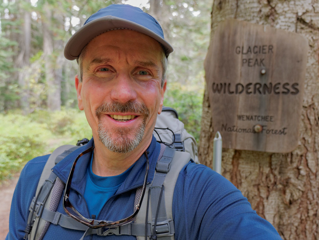
The Spider Gap–Buck Creek Pass trip is well described in Backpacking Washington by Douglas Lorain. With side trips, the route can cover up to 53 miles. I skipped Flower Dome and High Pass due to weather, so I probably covered about 42 miles in four days. I’ve poked at this area before, but this is the first time for the whole loop. I did the trip in mid-September, so bugs weren’t an issue, but the days were definitely getting shorter and hunters could be a concern. The trip started cloudy and cool, but with markedly improving weather forecast for the next two days. After an easy forest walk along Phelps Creek, the views began when Spider Meadows opened up to the Chiwawa Mountains.

The climbing really starts after the meadows with wonderful ethereal views.

The trail switchbacks up to some high camps right at the base of the tiny Spider Glacier, the source for Phelps Creek. The rock starts to go orange as the views back to Seven Fingered Jack grow and grow.

The Spider Glacier (really just a snowfield) is not very steep and is an easy ascent. Microspikes or Yaktrax might be a help early in the day or season. I felt no need for an ice axe.

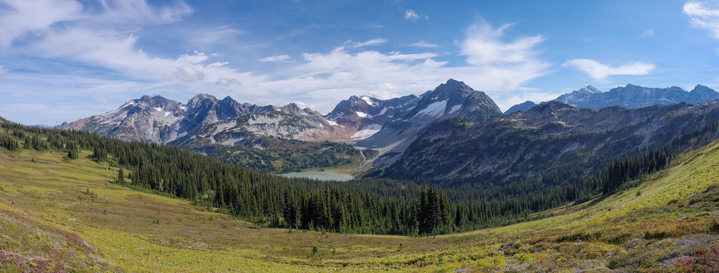
Once the pass is cleared, the view of the Lyman basin is spectacular. I was treated to some amazing clouds …

… but since the light was fading, I soon started looking for a place to camp. I wanted to stay high since the morning views should be spectacular. I just needed to get far enough down to get water. The snowfield descent was gradual and easy, and I found a good small spot for my tent on the rocks high above Upper Lyman Lake. The next morning, I was rewarded with spectacular shadows on Lyman Glacier and a few icebergs in Upper Lyman Lake. I spent much of the morning photographing the glacier before heading down Railroad Creek to the main Lyman Lake.

Once down to Lyman Lake, I got some great views of Bonanza Peak, especially from the west side of Lyman Lake where it is reflected in some lovely grass-spattered ponds.

Continuing around the west side of Lyman Lake brought me to Railroad Creek and this lovely cascade flowing down from the Upper Lyman Lakes.

From there, the trail climbs up from Lyman Lake to Cloudy Pass, and the views over to Cloudy Peak and Bonanza are wonderful. There is a good camp in the meadows here to allow leisurely exploring up Cloudy Peak and beyond to North Star.

As I approached Cloudy Pass, I was able to look back at the entire day’s hiking from just below Spider Gap, past Upper Lyman Lakes, down to Lyman Lake, around to the Railroad Creek cascade and up to where I stood when I took the below photo. I just love to see the extensive territory that can be covered under human power, especially territory as lovely as this.
The trail drops down after Cloudy Pass, and there is a good shortcut over to Suiattle Pass. After a bit of a forest walk, the trail heads toward Image Lake and traverses Miners Ridge. Great views of Fortress Mountain …

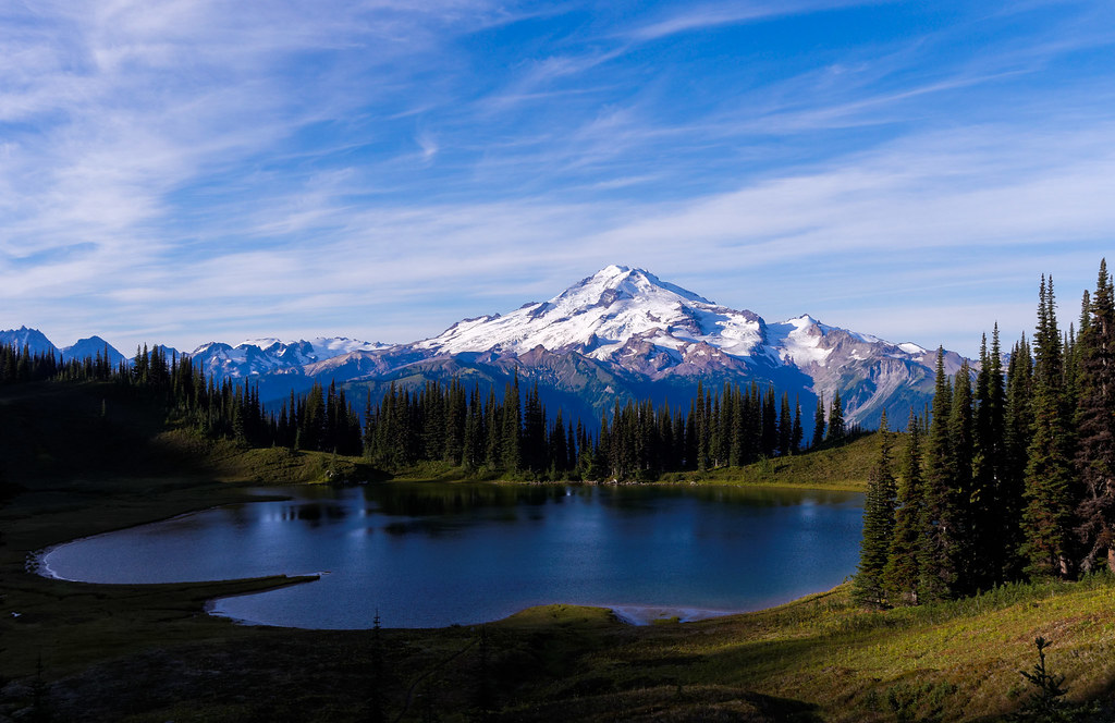
… and Glacier Peak opened up abruptly as I walked in an attractive meadow below Plummer Mountain. The light was turning golden, and I had to hurry to get to Image Lake before dark.

On the third morning, I discovered I was the only person at Image Lake—amazing. The trees between the lake and Glacier Peak have grown over the years, so the classic picture has changed some, but beautiful photos can still be taken.

I hung out at Image Lake from first light until the sun glimmered on the lake. What a treat to see the sun and reflections painting on the water.
It is such a scenic area that even my campsite had a stunning view.

I retraced my steps along Miners Ridge, down to the Suiattle River. I met a few Pacific Crest Trail (PCT) thru-hikers finishing up Washington—it was that time of year.

I passed this gorgeous and surprisingly unnamed creek.

After dropping all the way to the river, I climbed back up to Middle Ridge on the way to Buck Creek Pass, providing a different view of Fortress Mountain.

Now I got to see the long traverse along Miners Ridge over to Image Lake.
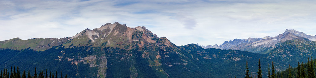
The clouds started to move in, but I made it up to Buck Creek Pass before dark and the rain. Surprisingly, there were no hunters in evidence at the pass, and I had a nice solitary camp.

It rained hard that night, and the next morning I awoke to clouds, so I decided to not go to High Pass and Triad Lake and proceeded to head out.

The weather improved later in the morning, so I had a nice forest walk out to Trinity. Luckily, I managed to get a ride back up to Phelps Creek Trailhead, saving me a three-mile road walk back to my car.

All in all, it was a very good trip and an area I definitely think we should return to in the future so Jean can see it in person.
All photos from this trip are on Flickr.


Leave a Reply