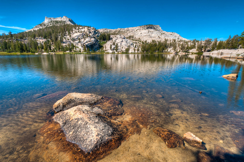
John Muir Trail — 2011

In August and September 2011, we backpacked the entire John Muir Trail (JMT) in California. We did it in two trips. The first, from Tuolumne Meadows in Yosemite National Park to the summit of Mount Whitney, was 22 days and 21 nights. The second was from Tuolumne Meadows to Happy Isles in the Yosemite Valley over three days and two nights. John was 58 and I was 57.

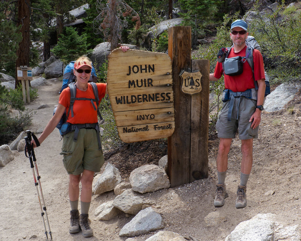
We were excited to begin this trip. It would be the longest backpack trip either of us had ever done. We both felt up to the challenge. We left Tuolumne Meadows feeling confident.
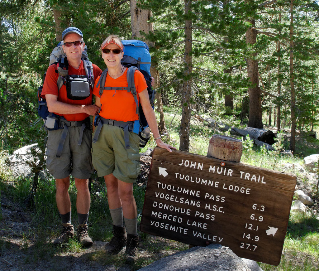
John and Jean starting the John Muir Trail, California

The hiking was easy through Lyell Canyon. We enjoyed the views of Lyell Fork.

Lyell Fork seen from the John Muir Trail in Yosemite National Park, California

We encountered our first of many stream crossings. Fortunately, this was shallow and there were stepping stones.

Jean on the John Muir Trail, California crossing Lyell Fork

The JMT crosses six mountain passes over 11,000 feet, and Donahue Pass was the first.

Jean and John on Donahue Pass (11,056 feet) along the John Muir Trail in Ansel Adams Wilderness, California

Once back in the valley, we continued down the trail.

Jean on the John Muir Trail in the Ansel Adams Wilderness, California

We thoroughly enjoyed the views we were getting of Banner Peak and Thousand Island Lake.

Banner Peak seen on the John Muir Trail, California

The trail periodically took us through wooded areas …

Juniper trees seen along the John Muir Trail in the Ansel Adams Wilderness, California

… and past lakes, including Rosalie …

Rosalie Lake along the John Muir Trail in the Ansel Adams Wilderness, California

… and Lake Virginia.

Lake Virginia along the John Muir Trail in John Muir Wilderness, California

We were also getting views of jagged mountains …

Seen from the John Muir Trail in John Muir Wilderness, California

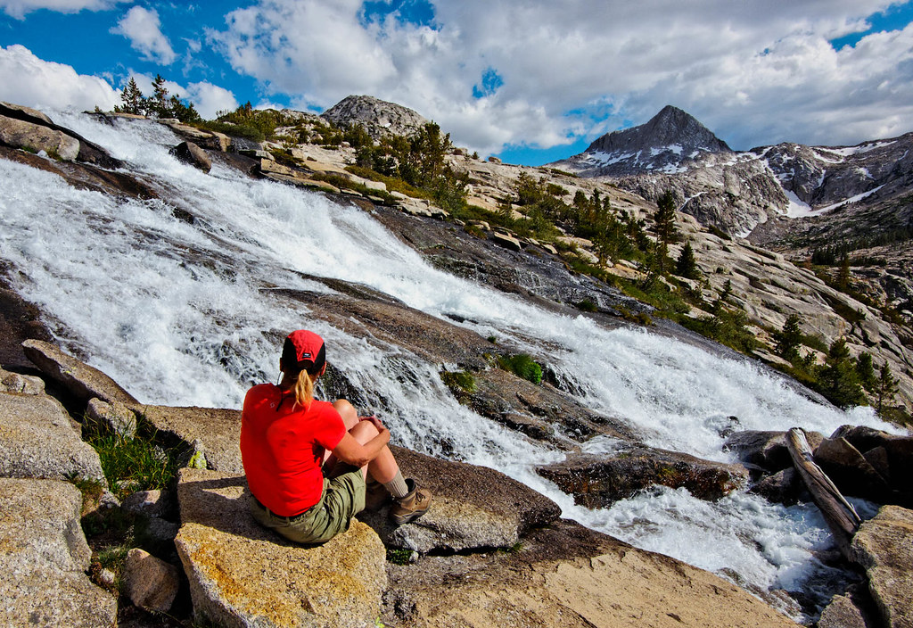
… and rushing streams.

Fish Creek along the John Muir Trail in John Muir Wilderness, California

Not to mention seeing green meadows …

Valley meadow seen from the John Muir Trail in John Muir Wilderness, California

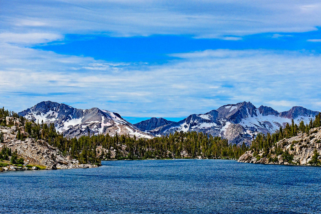
… and more mountain lakes.

Squaw Lake along the John Muir Trail in John Muir Wilderness, California

John did quite a bit of photography at Chief Lake, and the photo below is my favorite.

At some point, someone from Getty Images contacted us. This large company provides stock images, and they wanted to pay us to add some of John’s photos to their collection. This photo was one that they chose. We never knew what happened to any of his photos …

Chief Lake along the John Muir Trail in John Muir Wilderness, California

… until one morning when I turned my laptop on. I was very surprised to see this photo on the start screen.
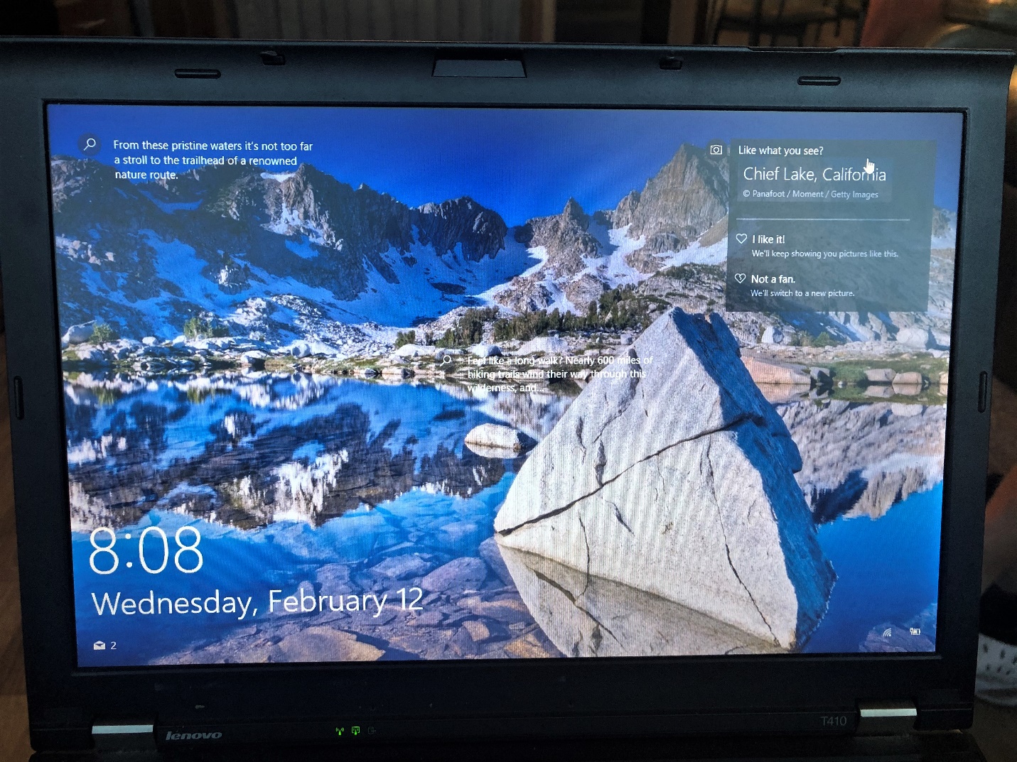
John’s Chief Lake photo on my laptop’s start screen

There is a lot of water along the JMT. In addition to the many lakes, there are quite a few creeks, streams and rivers. There are often gorgeous waterfalls.

Jean and the North Fork of Mono Creek along the John Muir Trail in John Muir Wilderness, California

Sometimes we had to cross these bodies of water. The smaller ones can often be crossed by rock hopping. Fortunately, the larger ones had bridges over them. These were most appreciated!

Jean crossing Fish Creek along the John Muir Trail in the John Muir Wilderness, California

But others must be waded. We both had water shoes with us, so our boots stayed dry.

Jean crossing Bear Creek along the John Muir Trail in John Muir Wilderness, California

As much as we love mountains, we thoroughly enjoy seeing the beautiful lakes nestled amongst them.

Marie Lake along the John Muir Trail in John Muir Wilderness, California

On the tenth day of the trip, we needed to get to the Muir Trail Ranch (MTR) to pick up our food resupply. MTR is a guest ranch just off the JMT, and we had reservations to stay one night there. The day before we arrived, we talked to three reserved middle-aged backpackers, and we were interested to learn they had spent a night at MTR. They quietly confirmed my hope that we could get showers and do laundry there. Then John asked them about the food. All three immediately became quite animated, and all talked excitedly. I was able to pick out things like “Oh, it was great … Chicken Marsala … side dishes … roast beef … salads … the desserts … and the breakfast … it was amazing!” It was like a comedy routine, and we couldn’t help but laugh (and couldn’t wait to get there).

We had one final descent to make before getting to MTR. Even though it was hot and that section of trail was exposed, I was feeling particularly happy. Then I saw a guy slowly making his way up the steep trail. He had his head down and was leaning heavily on his trekking poles. I couldn’t tell his age, but as he got closer, I could tell he fell into the “older than me” category. I stepped aside to let him pass. Feeling sympathetic, I gently said, “How’s it going?” He stopped. He looked up. His face was covered in sweat. And then, he broke out with a huge smile and said, “I’m alive and I am here. It doesn’t get better than that.” His words have stayed with me.

MTR exceeded our high expectations. After the hot showers, we did our laundry and impatiently waited for the dinner bell. The food was more than we had imagined. It was all-you-can-eat, and we went from eating 3,000 calories a day to eating more than that in one meal.

Muir Trail Ranch

Jean sorting food from our resupply buckets in our cabin at Muir Trail Ranch

After the food, the next greatest luxury at MTR was the private hot springs. We decided to take a day off and spent a second night there. It seemed like a great way to celebrate our upcoming 32nd wedding anniversary.

Jean and John enjoying one of the wonderful private hot springs

Feeling rejuvenated from our time at MTR, we happily continued down the trail, which was good because we were carrying 11 days of food and our packs were quite heavy.

Jean and the South Fork of the San Joaquin River along the John Muir Trail in Kings Canyon National Park, California

We encountered another creek crossing, this time Evolution Creek.

Jean in Evolution Creek, one of the two creeks we had to wade across. On the John Muir Trail in Kings Canyon National Park, California

Evolution Creek would be our companion for a while as the trail followed it upstream …

Evolution Creek along the John Muir Trail in Kings Canyon National Park, California

… revealing its many moods.

Jean and Evolution Creek at the outflow of Evolution Lake near the John Muir Trail in Kings Canyon National Park, California

After gaining more elevation, the terrain became more austere.

Seen from the John Muir Trail in Kings Canyon National Park, California

At times, the only color in an otherwise gray landscape was the bright blue of the lakes.

Wanda Lake and Lake McDermond along the John Muir Trail in Kings Canyon National Park, California

This continued as we descended from Muir Pass.

Jean descending from Muir Pass on the John Muir Trail in Kings Canyon National Park, California

Once we had descended, the color green was in evidence again.

Unnamed stream along the John Muir Trail in Kings Canyon National Park, California

Once again, we saw lovely waterfalls …

Middle Fork of the Kings River seen along the John Muir Trail in Kings Canyon National Park, California

… and rushing water. Surprisingly, this robust river …

Middle Fork of the Kings River seen along the John Muir Trail in Kings Canyon National Park, California

… calms down when it flows through this lovely meadow.

Middle Fork of the Kings River seen along the John Muir Trail in Kings Canyon National Park, California

The trail gained elevation again, and we encountered another rushing stream. I couldn’t imagine this one ever calming down.

Palisade Creek along the John Muir Trail in Kings Canyon National Park, California

Before long, it was time to ascend another pass.

Jean ascending Mather Pass (12,100 feet) on the John Muir Trail in Kings Canyon National Park, California

Once at a pass, we rewarded ourselves with a short break to enjoy the view to the other side.
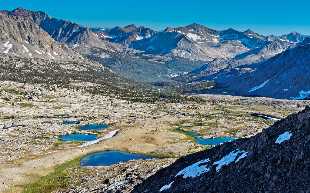
Seen from Mather Pass (12,100 feet) along the John Muir Trail in Kings Canyon National Park, California

Once over a pass, we set our sights on the next one.

Jean heading to Pinchot Pass (12,130 feet) on the John Muir Trail in Kings Canyon National Park, California

All this hiking is hard on feet. So, we developed the habit of taking our lunch break at a stream.

John and Jean soaking their feet in Woods Creek along the John Muir Trail in Kings Canyon National Park, California

After putting our boots back on, our feet were willing to carry us down the trail.

Jean on the John Muir Trail in Kings Canyon National Park, California

A particularly beautiful area is Rae Lakes and the nearby Painted Lady.
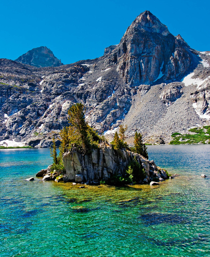
Painted Lady (peak) and Rae Lakes seen from the John Muir Trail in Kings Canyon National Park, California

There are six passes over 11,000 feet, and we had two more to go. We headed up the steep switchbacks toward Glen Pass. On our way up …

Jean headed to Glen Pass (11,978 feet) on the John Muir Trail in Kings Canyon National Park, California

… we encountered the most photographed natural wonder seen on the trail. Carol, at 77 years young, was backpacking the entire JMT. Everyone wanted to take her picture! She was so inspirational!

Ascending Glen Pass (11,978 feet) on the John Muir Trail in Kings Canyon National Park, California

The final pass we needed to get over was the highest, Forester Pass.

John ascending to Forester Pass (13,200 feet) on the John Muir Trail in Kings Canyon National Park, California

It was challenging. But as I slowly made my way up the steep switchbacks, I recalled the words of that old guy I had encountered. I thought to myself, “I’m alive and I’m here. It doesn’t get any better than this.”

Jean ascending to Forester Pass (13,200 feet) on the John Muir Trail in Kings Canyon National Park, California

At this altitude, we sometimes needed to stop and catch our breath. But that gave us the opportunity to look back and enjoy the view.

Seen while ascending to Forester Pass (13,200 feet) on the John Muir Trail in Kings Canyon National Park, California

The higher we got, the better the views.

Seen while ascending to Forester Pass (13,200 feet) on the John Muir Trail in Kings Canyon National Park, California

We were both tired but quite happy to reach the pass.
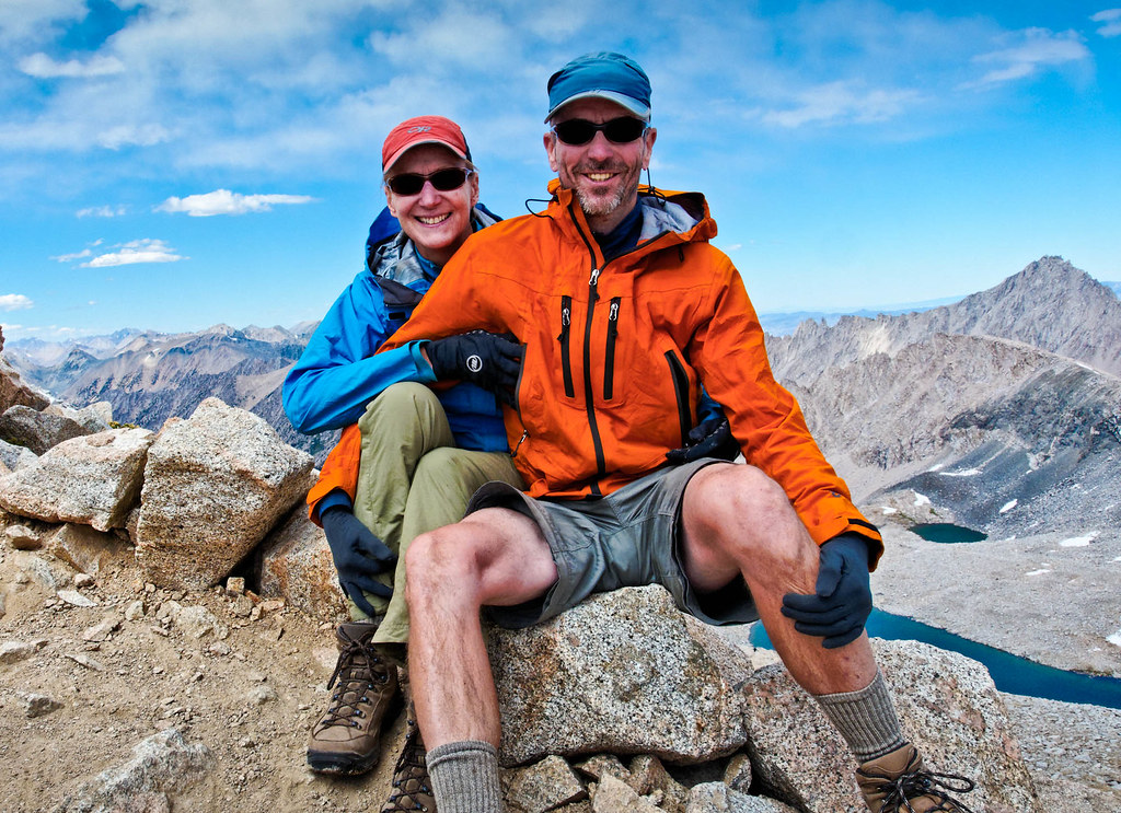
Jean and John at Forester Pass (13,200 feet) on the John Muir Trail in Sequoia National Park, California

We had left Kings Canyon National Park and entered Sequoia National Park when we crossed Forester Pass.
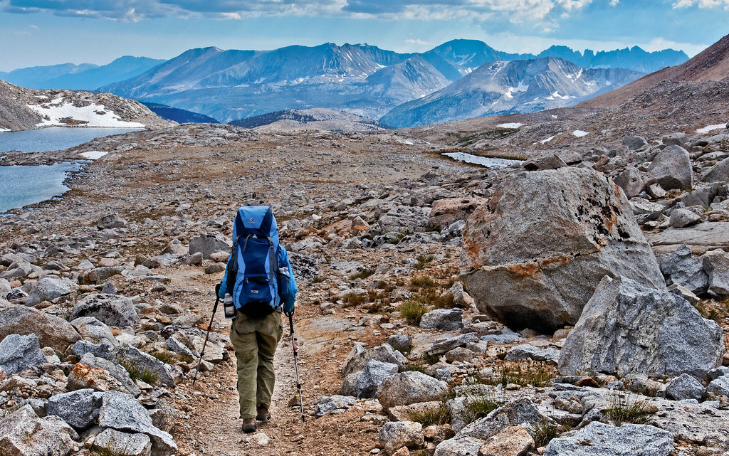
Jean on the John Muir Trail in Sequoia National Park, California

We enjoyed seeing the lovely jagged peaks of Kearn Ridge in the distance.
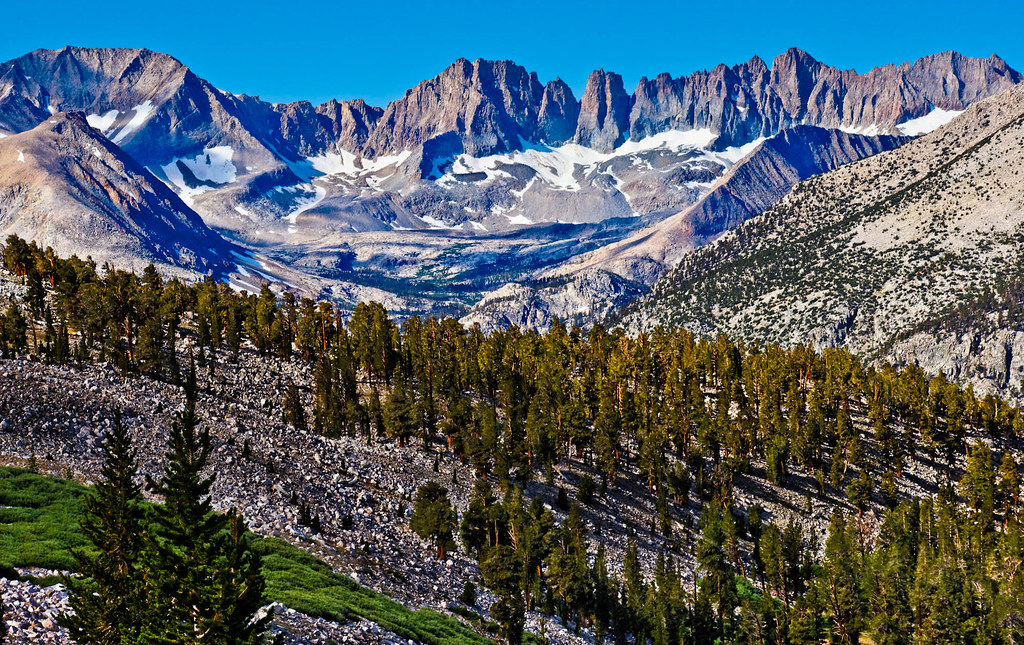
Kearn Ridge seen from the John Muir Trail in Sequoia National Park, California

We planned to camp near Guitar Lake for our last night on the JMT.
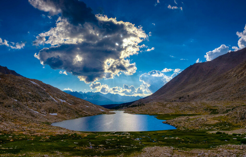
Guitar Lake seen from the John Muir Trail in Sequoia National Park, California

We found a secluded spot above the lake.
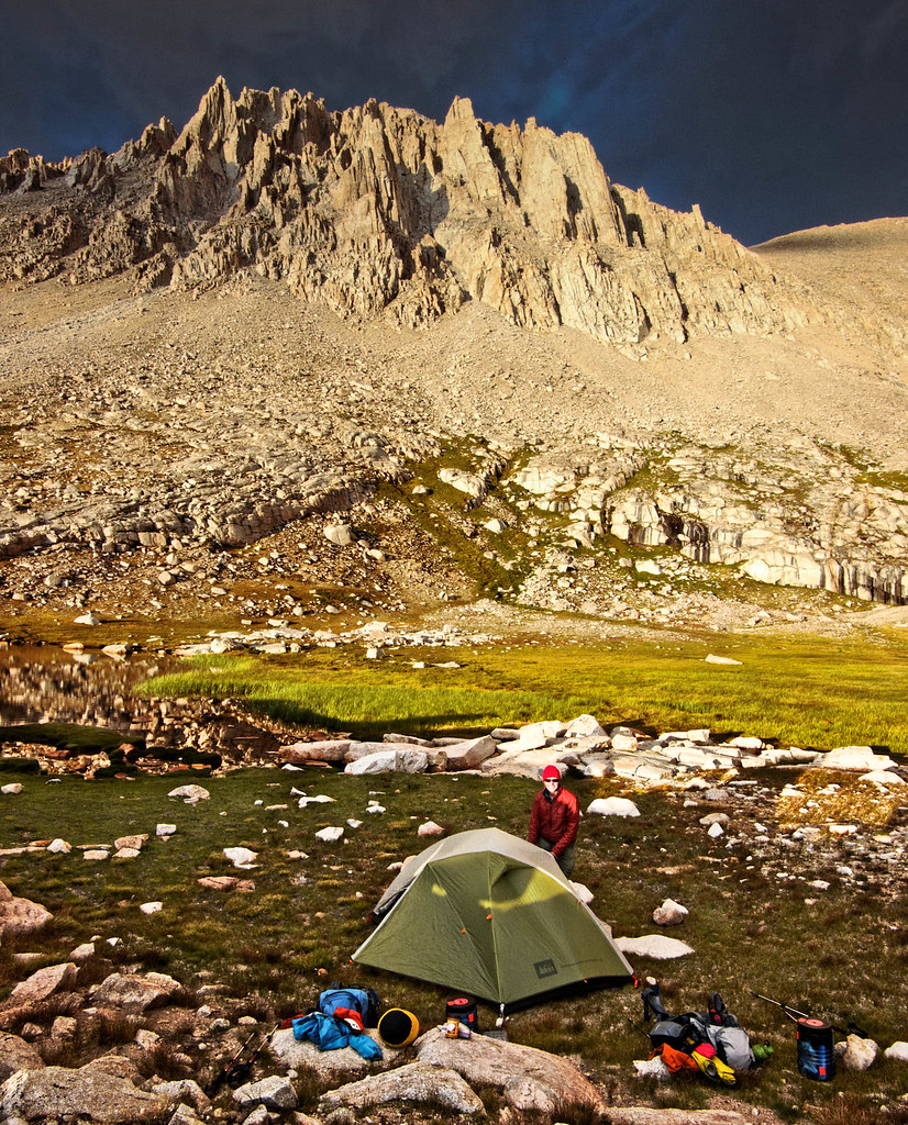
Our camp above Guitar Lake on the John Muir Trail in Sequoia National Park, California

We got up early and headed up the trail.
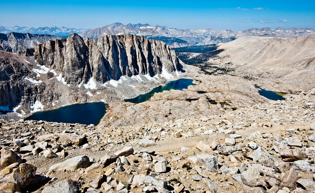
Seen from the John Muir Trail while ascending Mount Whitney in Sequoia National Park, California

Standing on the summit, we both felt a strong sense of satisfaction.
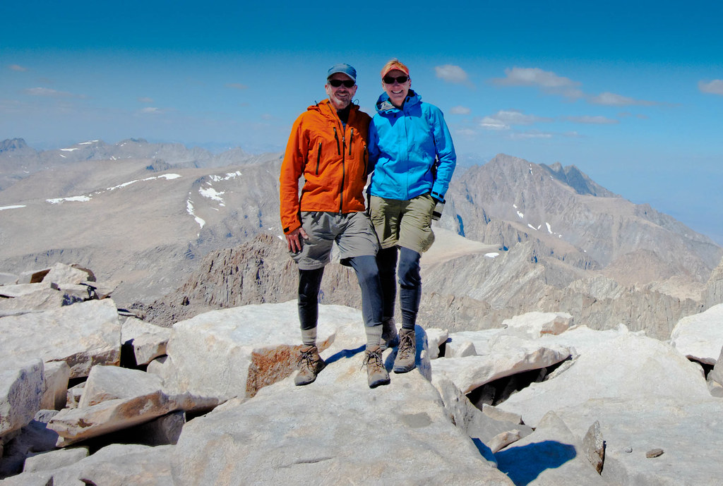
John and Jean on the summit of Mount Whitney (14,505 feet) after completing the John Muir Trail in Sequoia National Park, California

We then started the long descent …

Jean descending Mount Whitney on the John Muir Trail with the Keeler Needles in the background. Sequoia National Park, California

… and headed down the countless switchbacks …

Jean descending on the Mount Whitney Trail in the John Muir Wilderness, California

… to Whitney Portal.

Jean and John at the end of the trail at Whitney Portal in the John Muir Wilderness, California

We couldn’t be happier with how this trip went. The weather was great, and wildfires were not an issue that summer. This trip sits firmly at the top of our list of favorite backpack trips.

All photos from this trip are on Flickr.

As we had started this trip at Tuolumne Meadows, we still needed to do the short section of the JMT from Tuolumne Meadows to Happy Isles in the Yosemite Valley. We did it over three days and two nights.

Jean on the John Muir Trail in Yosemite National Park, California

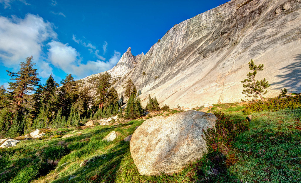
Cathedral Peak is a lovely sight.

Cathedral Peak in Yosemite National Park, California

We camped there the first night …

Seen from the John Muir Trail in Yosemite National Park, California

… and John took some time to do some photography …

Seen from the John Muir Trail in Yosemite National Park, California

… including Cathedral Lake.

Cathedral Lake seen while hiking the John Muir Trail in Yosemite National Park, California

During this trip, we also did a side trip and climbed Half Dome, probably Yosemite’s most famous feature.

Half Dome seen from Glacier Point in Yosemite National Park, California

This is one of those iconic hikes and is extremely popular as a day trip from the valley. However, we would camp nearby on our second night out. We wanted to get to the top by sunrise, so we left camp at 3:30 a.m. Initially, it was easy to follow the trail by headlamp. However, once we reached Subdome, it was disconcerting to not be able to see our destination as there is no marked route across the rock surface. In daylight, it would have been no problem. We were quite relieved to finally see the beginning of the cables on Half Dome.
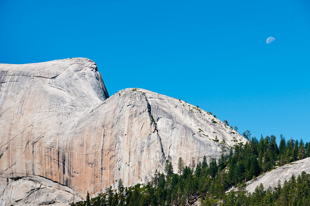
The route up Half Dome first crosses Subdome from the right. Not easy to see in the dark!

The last 400 feet of elevation gain, and the most challenging for many individuals, require the use of two cables to climb the extremely steep rock. It is slow and extremely crowded for much of the day. However, with our early start, we had the cables completely to ourselves. We were the first people on the summit. We had it to ourselves for about 15 minutes before a few more individuals arrived.
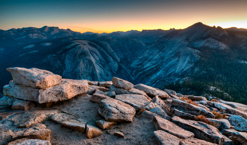
Sunrise seen from the top of Half Dome in Yosemite National Park, California

There were only about a dozen of us there for sunrise, much more pleasant than being with the hundreds of people who would be there later in the afternoon.

Sunrise seen from the top of Half Dome in Yosemite National Park, California

The cables still get quite crowded around midday. I heard from a fellow that it had taken over an hour to get down the cables the previous afternoon. However, when we started down about 7:30 a.m., there were only a few individuals coming up, so it was pretty quick (but not too quick!).
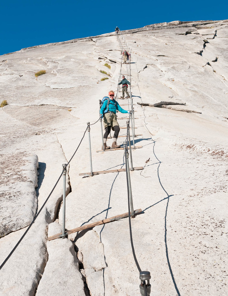
Jean descending Half Dome on uncrowded cables in Yosemite National Park, California

I am the first to admit it had not been easy to get up in the middle of the night. But it was well worth it for the rare privilege of being in such an iconic spot in solitude.

John and Jean with Half Dome in Yosemite National Park, California

As we headed down the trail, we encountered countless day hikers. Nevada Falls is a very popular destination.

Liberty Cap and Nevada Falls seen while hiking the John Muir Trail in Yosemite National Park, California

Compared to our hike down from the summit of Mount Whitney, this hike down to the Yosemite Valley was a bit anticlimactic. However, once we got down to the Yosemite Valley, we could now say we had hiked the entire JMT!

All photos from this trip are on Flickr.

Comments

Leave a Reply