In August 2012, we did a seven-day, six-night backpack trip on a modified Northern Loop in Glacier National Park, Montana. John was 59 and I was 58.
We started (and would end) this trip on the Granite Park Trail. Glacier National Park provides backcountry campgrounds, and we hoped to stay in what we believed would be the most scenic. Getting the necessary permits was challenging. We were happy to get our top three choices. However, it was necessary for us to spend the first three nights in less desirable campgrounds. In fact, on the first night we would be staying in the Many Glacier Campground, a huge car campground, which has three tent sites reserved for backpackers.
Some last-minute issues led to our not starting until noon, and we had nearly 12 miles to go with significant elevation gain. Our packs were heavier than we had carried for many months. The first four miles were through a burned-out forest. The sun was hot, and the going was quite slow. We planned to take a break at the historic Granite Park Chalet, and I had been fantasizing about purchasing a cold beverage. However, I was sorely disappointed to see a sign on the refrigerator that said it wasn’t plugged in and was only used for storage. I settled for a lukewarm Mountain Dew.

We continued up the trail toward Swiftcurrent Pass, and once we got above the treeline, the views improved.
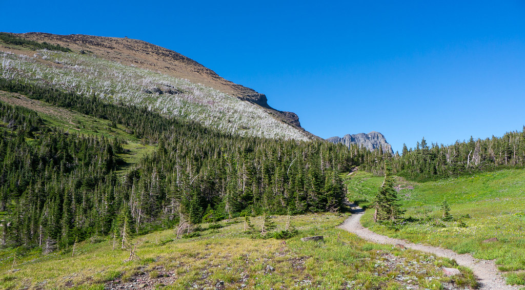
I think the most scenic part of this trail comes on the other side of the pass once you round a bend and begin getting views of the Swiftcurrent Headwall. Water from the melting of the Swiftcurrent Glacier above creates numerous beautiful waterfalls flowing over the steep walls.

The trail descends steeply until it drops below the treeline and into brush. It was beginning to get dark, and we knew it was advised not to hike during dusk or after dark due to the increased probability of encountering wildlife, namely bears and moose. We did encounter a moose cow and calf browsing in the thick brush surrounding the trail. She was so close to the trail that we could have touched her. Fortunately, she was surprisingly unconcerned about us and eventually moved just far enough away from the trail so we could cautiously slip by.

The trail continued to descend along Swiftcurrent Creek past several lakes—Bullhead, Red Rock, and Fisher Cap—and was quite easy. However, once it entered the thick woods, it became much darker, and we became more concerned about the possibility of encountering bears along the trail. Fortunately, we arrived without incident at the Many Glacier Campground about 10:30 p.m., tired enough not to mind the luxury of the picnic table and flush toilets.

The next day was by far the least scenic part of the entire trip (John did not take a single photograph). We had to first walk about two miles through parking lots and on nature trails but primarily along the road in order to get to the Red Gap trailhead.
Once we finally got on the wooded trail, we noticed ripe berries on nearby bushes, so we weren’t surprised to see fresh bear scat. We didn’t encounter any bears, but we talked to some folks hiking out who had. Once we got to the woodsy Poia Lake Campground, we heard that there had been grizzlies on the other side of the lake, adjacent to the trail we would be taking the next morning.
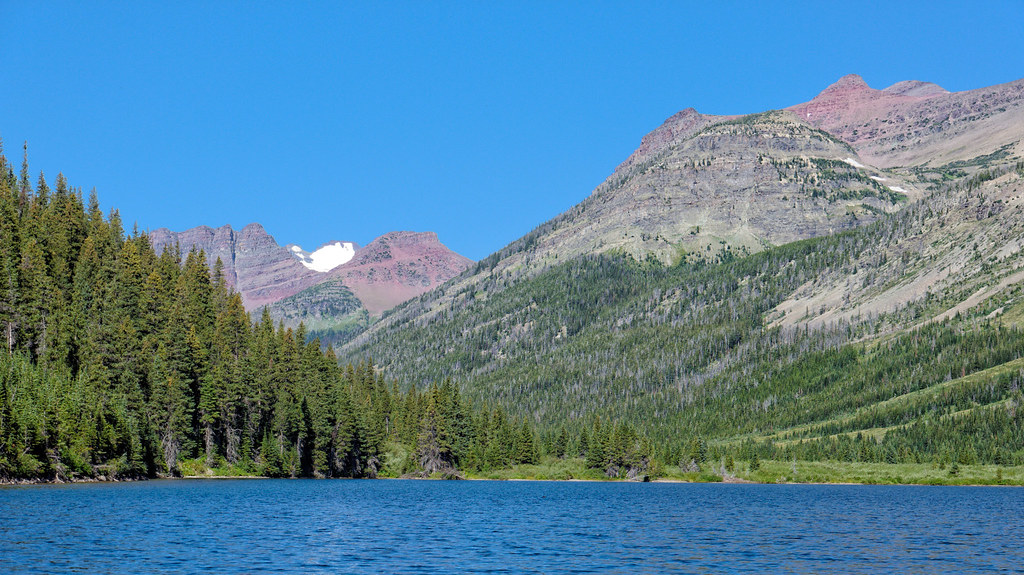
The next day, we headed toward Red Gap Pass (no bears near the trail … at least that we were aware of). The trail was fine, steadily gaining elevation until the last portion when it became quite steep with pathetic switchbacks through scree. This is the kind of trail I much prefer hiking up rather than sliding down, but it was worth the effort as views from the pass were great.

Once over Red Gap Pass, we descended toward Elizabeth Lake to hook in with the Ptarmigan Trail for a short distance before turning off on the Belly River Trail that would take us to the Gable Creek Campground. While we were hiking, I noticed motion in the brush below us next to the river, and we had our first bear sighting. However, at that point, the trail was well above the water, and we were able to safely watch the bear lope across the river.

The next morning, we happily left the congested Gable Creek Campground as we were finally on our way to the areas we most wanted to see. We took the Cosley Lake Cutoff that would take us directly to the Stoney Indian Trail. We took the short trail to see the gorgeous Gros Ventre Falls along the way.

The trail then skirted Cosley Lake and followed the Mokowanis River upstream to Glenns Lake. The trail continues the length of this elongated lake, and we had another wildlife sighting, this time a bull moose browsing in the shallow water. We thoroughly enjoyed watching him dunk his head and come up with a mouthful of vegetation and an antler full of water.

Shortly after reaching the end of the lake, we reached the Mokowanis Junction. There is a popular campground at the junction that some use as a base camp for day hiking to Mokowanis Lake (and beyond to Margaret Lake) as well as Stoney Indian Pass. However, we continued up the short side trail to the Mokowanis Lake Campground, which is less crowded and more scenic. Views from the lake were amazing!
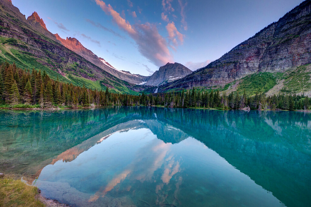
Other backpackers at the camp let us know that it was possible to get much closer to the waterfalls located at the head of the lake. John did the short but time-consuming bushwhack/scramble up for better photo opportunities of the Pyramid Creek Falls that flow from Margaret Lake.

The next day, the trail continued up the increasingly scenic Stoney Indian Pass Trail. We encountered an unexpected water crossing, but we had brought water shoes just in case. We always look for a place to rock hop across, but sometimes it is less time-consuming to just take your boots off.

The trail continued up past waterfalls …

… and through a beautiful meadow.
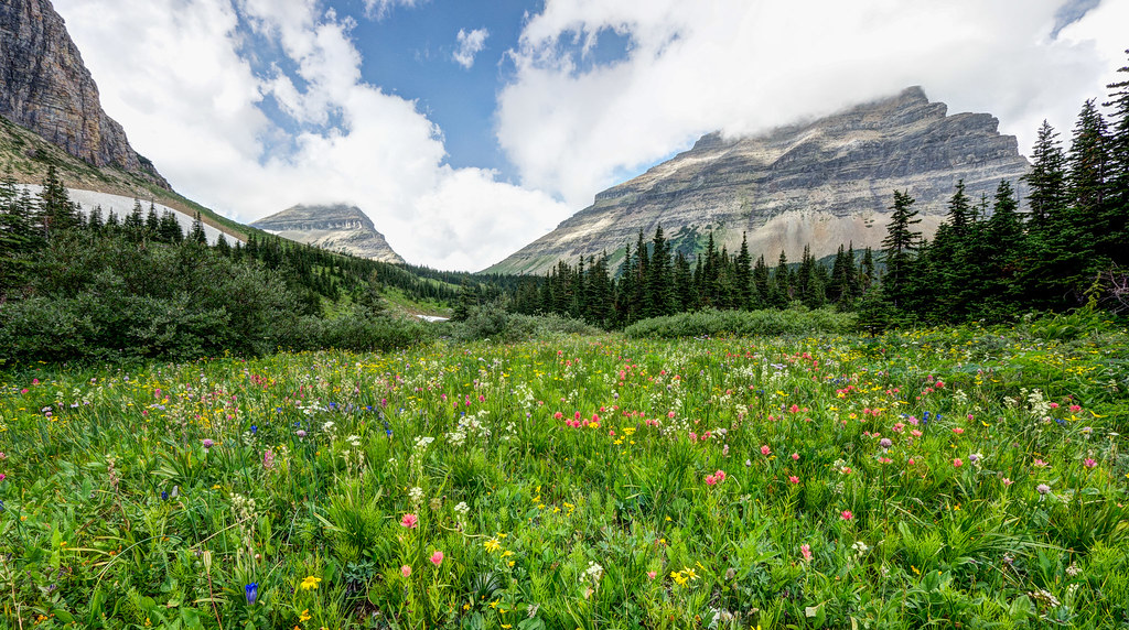
We had hoped to take a leisurely food break and enjoy the views, but mosquitoes were voracious. However, we were both hungry and found that our parkas and rain pants provided just enough protection to enable us to take a quick break before continuing on our way toward Stoney Indian Pass. After crossing the pass, we began getting views of Stoney Indian Lake below, our destination for the night.

The next day, our trail descended through woods and was incredibly brushy at times. We eventually intersected the Waterton Valley Trail that would take us to the Fifty Mountain Campground. I had hoped we were done with brushy trails. We weren’t.

We finally got above the brush and enjoyed expansive views as we approached Fifty Mountain. On our last night out, we camped at the Fifty Mountain Campground (presumably named because one can see 50 mountains from the area) and found it to be quite crowded. In addition to the usual number of backpackers, there was a group of geologists doing soil mapping of the area. However, we were happy to discover that the most remote—and, in our opinion, the most desirable—campsite was still vacant.

Backcountry campgrounds have designated eating areas well away from any of the campsites. The objective is to keep food odors away from tents. We knew there were bears in the area from some fresh bear paw prints that John had seen in some mud not far from camp.
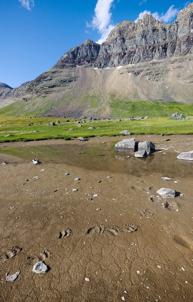
Later, when we were in our tent after dark, we were perplexed by flashes of light visible periodically through the tent fabric. The mystery was solved when I left the tent to pee. We didn’t know it at the time, but we were witnessing the Perseid meteor shower. We stayed up to watch it until the cold drove us inside, but we could still see some of the show through the doors of our tent from the comfort of our sleeping bags. Not bad for our last night out.
The next morning, we had two options for getting back to where our car was parked. We could either take the brushy Flattop Trail or the longer but more scenic Highline Trail toward Swiftcurrent Pass and back down the Granite Park Trail. Our concern about the Highline Trail was the Ahern Drift, a snowfield covering a portion of the trail. Unfortunately, we had not been able to get any first-hand information about it. But we were both fed up with brush, so we decided that we’d rather cope with snow.
Shortly after leaving camp, John did a quick side trip to see Sue Lake. I stayed behind to guard our packs from marmots.
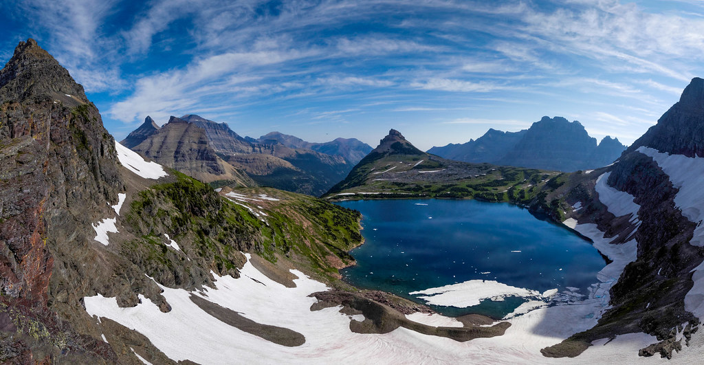
We were a bit anxious about the Ahern Drift until we finally encountered someone who had come through it and learned it was easy to drop below it on the scree slope.

After crossing Swiftcurrent Pass, we once again passed the Granite Park Chalet.

We continued down the same trail through the burned-out forest that we had struggled up the week before. Not the most attractive beginning and end for a backpack trip, but we couldn’t be happier with how this extremely scenic trip went.
All photos from this trip are on Flickr.


Leave a Reply